Capture Calif

Capture California

What is a YOLT? Well, you may have heard the term YOLO. Gary and Sherri think we can live again, not as James Bond, but as being reborn. Consequently, we are having fun in our life, after all, You Only Live Twice.

Friday, June 29, 2012

Adventure 096 - Moaning Cavern


Capture California, the Game-2012
Adventure: 096 – Moaning Cavern
Team: Thing One, Thing Two
Date:  June 29, 2012
Location: Angel's Camp/Vallecito

Description:
The first modern discovery of Moaning Cavern was in 1851 by gold miners. When they found out that there was not gold at the bottom of the cavern, they moved on to other possible happy diggings. Of course, judging by the pre-historic bodies which have been found at the bottom of the cavern, others found the cavern, but maybe only briefly lived to see it. Then in 1919, the cavern was rediscovered and realized it could be a pretty good tourist attraction. It is thought that the first tourists were lowered down in ore buckets, with candles of whale fat to light their way. Access was made “easier” when a 100', 144 step, steel spiral staircase was installed. The stair case was built from a World War I battleship. Now visitors take a 235 step staircase, including the spiral staircase, down into the pits of the cavern.


From there you see such rooms as the the Meat Grinder with its stalagmites ready to tenderize you, Godzilla’s Nostril's-a muddy tunnel which has a repugnant fragrance, Pancake Squeeze—you can guess how come, Santa's Nightmare-with a narrow vent, and The Guillotine-a head-size tunnel missing only a blade. The general public is allowed only into the first 165' of its 411' depth. But one can also do spelunking and zip-lining at the facility.


Adventure 051 - Historical Landmarks


Capture California, the Game-2012
Adventure: 051 – Historical Landmarks
Team: Thing One, Thing Two
Date:  June 29, 2012
Location: Various


Description:
Thing One and Thing Two took a leisurely drive down Highway 49. One of the great things about this highway, in addition to the scenery and the interesting road work, is the historicalness of the route. Each town has a claim to an important historical event, even spots on the road with just a marker shows places of importance. With an abundance of choices, we decided to give you only two of them:


  • Chili Gulch. This site is #265 of the California Landmarks and commemorates the Chilean miners who worked the area around Angel's Camp, in a place where the Chilean miners congregated. They found the riches area to placer mine (gold pan) in the Calevares area. Also they found the biggest quartz crystal on record from one of their mines. But then were forced out when the Americans in the area realized what the Chilean's had. This became the Chilean War. Even Joaquin Murietta may have become involved in the conflict, on the side of the Chilean's. Having lost the war and several lives, the Chilean's were forced to leave their rightful claims. The marker can be found at N38.2160293, W120.707433, just a little north of San Andreas.
  • Fremont Fort. While not a designated California Landmark, it does have a nice monument attached to the site. General John C. Fremont operated three mines—Josephine, Pine Tree and Princeton--between Mariposa and Oakhurst. While Fremont was away during some of his travels, he found that many of his claims and mines had been “jumped”. Taking back his mines, he found himself in the middle of violent situation. So he built himself a fort around this spot to protect the “only” way into the area and keep his claims from jumpers. The monument was put up by the E Clampus Vitus organization on May 29, 1994. Looking back down Highway 49, you can understand the strategic spot for the fort.


Adventure 053 - Chaw'se


Capture California, the Game-2012
Adventure: 053 - Chaw'se
Team: Thing One, Thing Two
Date:  June 29, 2012
Location: Chaw'se – Indian Grinding Stone State Historic Park

Description:
Chaw'se, literally means grinding stones in the language of the Miwoks. And that is what this State Historical Park is known for. One of two, and by far the largest, grinding stone with petroglyphs. It also features the largest grinding stone with 1,185 mortar holes. Some of the petroglyph carvings are thought to be 3,000 years old and as such can be hard to see. We have found that in our visits here, it is easier to see the carvings during the evening or morning hours, rather than in the direct sunlight, like when we visited this time.


The grounds also feature a complete village of teepee's and a ceremonial hun'ge (roundhouse). The roundhouse still is in use during Big Time events (Pow Wow's). Also the Chaw'se Regional Indian Museum is located at this State Park and contains items showing the Miwok culture and how the coming of European's altered the Miwok's way of life. One thing of local interest for us was the mention of Fort Miller, now underwater at Friant Reservoir. Even more important than the factual, is the flavor of the area. You see, dimly, some of the things which the Miwok held sacred. As the Sierra Nevada Virtual Museum says, Chaw'se is not only a place, but a state of mind.


Adventure 008, Hike 030 - South Nature Trail, Chaw'se


 Capture California, the Game-2012

Adventure: 008, Hike 030 – South Nature Trail, Chaw'se

Team: Thing One, Thing Two

Date:  June 29, 2012
Location: Chaw'se / Indian Grinding Stone State Historical Park
Hike Info:
Trail: South Nature Trail, Chawse
Distance: .7
Description:
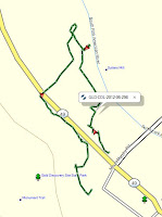
 The South Nature Trail is a companion trail to the North Trail. But it is not a repeat of the North Trail. It is surprising how in such a small park, where two trails so close together—they even share about 100 yards of trail—could be so different. While the North Trail is more arid, the South Nature Trail is close to Else Creek. This creek makes for the more moist feeling of the area. As a nature trail, there is 13 points guides, of interest on this self-guided tour. Unfortunately, the box was out of guide booklets, so we guessed what was at each number. Also we went backwards as well. But it was an interesting walk. As we neared the beginning, the trail went close to the park boundary. It was a bit unnerving seeing places where its neighbors would enjoy the settings with their own chairs and tables. Also it looked like there must have been some sort of need for the State to clear brush as we saw a lot of evidence of new growth madrone being cut. Still an interesting and good trail.

Adventure 008, Hike 029 - North Trail, Chaw'se


Capture California 2012, the Game
Adventure: 008, Hike 029 – North Trail, Chawse
Team: Thing One, Thing Two
Date:  June 29, 2012
Location: Chaw'se / Indian Grinding Stone State Historical Park
Hike Info:
Trail: North Trail, Chawse
Distance: 1.6
Duration: 1:17
Elevation Rise: 241'


Description:
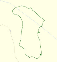
From last September to now, this trail has been improved by a combination of volunteer and State worker partnership. A good part of this trail is now open and accessible to those with mobile restrictions. After about three-quarters of a mile, there is a bench for us to rest at close to the highest point of the trail. But before that, one of the improvements is a new bridge across Else Creek, along with widening and leveling of the trail.


There is a couple variations to this trail. It starts at the Chaw'se Visitor Center and heads northwards, close to the highway. The surrounds is a lot of scrub trees, oaks, and madrones. At one point in the trail, the madrones and manzanita provides a covering which makes yo feel like you are traveling through a red-lined tunnel. At one point, the trail breaks off into a looping area, which eventually rejoins the North Trail close to the bench. After this, the trail starts to descend until it reaches the meadow outside of the Visitor Center. About at this point there is another trail leading to the U' Macha' Tam' Ma' Environmental Camp. As you pass through the meadow, you come across a replica of a Native American teepee village, along with a roundhouse. The trail co-mingles with the South Nature Trail for a hundred yards before going past the Indian Grinding Stones. At this point it is a short walk back to the Visitor Center.


This hike is best done in the evening or morning if done during the summer months.


Adventure 051, Site 181 – Sutter's Mill

 Capture California, the Game-2012
Adventure: 051, Site 181 – Sutter's Mill
California Landmark Number: 530


Team: Thing One, Thing Two
Date:  June 29, 2012
Location:
Latitude: 38° 48.209′ N
Longitude: 120° 53.537′ W
Address: Marshall Gold Discovery State Historical Park
Description:

We all know that James Marshall discovered gold along the South Fork of the American River in 1849 while constructing Sutter's Mill. But sometimes it is good to come back and think about how different life would have been if gold had not been discovered. That is the opportunity which Thing One and Thing Two had when they did Adventure 52 at this historic place.


NO. 530 GOLD DISCOVERY SITE - This monument marks the site of John A. Sutter's sawmill. In its tail-race, on January 24, 1848, James W. Marshall discovered gold and started great rush of Argonauts to California. The Society of California Pioneers definitely located and marked the site in 1924 - additional timbers and relics, including the original tailrace unearthed in 1947, were discovered after the property became a state park. The State erected the Marshall Monument overlooking this spot in 1890 through efforts begun in 1886 by the Native Sons of the Golden West.
Location: Marshall Gold Discovery State Historic Park, follow trail from Gold Discovery parking lot to American River, State Hwy 49 (P.M. 23.3), Coloma


Inscription as found on HMDB:
This rock monument marks site of John A. Sutter's saw mill in the tailrace of which James W. Marshall discovered gold, January 24, 1848, starting the great rush of argonauts to California. The Society of California Pioneers definitely located and marked site in 1924. Additional timbers and relics, including original tailrace unearthed in 1947, were discovered after property became state park. Marshall Monument overlooking this spot was erected following movement inaugurated in 1886 by Native Sons of the Golden West.

Tablet placed by Historic Landmarks Committees Native Sons and Native Daughters of the Golden West January 24, 1948 on centennial of gold discovery.


References:


Overall Landmark References:

Adventure 008, Hike 028 - Marshall Monument


Capture California, the Game-2012
Adventure: 008, Hike 028 – Marshall Monument Trail
Team: Thing One, Thing Two
Date:  June 29, 2012
Location: James Marshall Gold Discovery State Park, Columa
Hike Info:
Trail: Marshall Monument Trail
Distance: 1.2
Duration: 40 minutes
Elevation Rise: 232'

Description:
When you walk the Levee Trail on the East side of the American River, you see this tall, slender white edifice rising from the woods and you wonder what is it. Then looking at a map, you say, oh cool, there is a trail to it. The trail starts close to the James Marshall Gold Discovery State Historical Park Visitor Center and then ascends sharply up a hill. It is will made, but with a good slope. You travel through oaks. Even crossing an old, but still in use, irrigation ditch. After the climb, you break out into a little park like area where there is a house which is a center for public outreach, some picnic benches and a water fountain under a grape arbor. The later was much appreciated since the way was getting warmer and we did not bring water with us. For those who feel inclined, there is a road to this place as well.


A short distance up a small mound is a large flat space. Rising up from this space is the James Marshall Memorial. In 1885 when Marshall died, he died very inconspicuously. In 1890, the people of Placerville felt the person who Discovered Gold should be honored. They with the State of California raised $9,000 for this monument honoring Marshall. He was interned there.


The trail back is the same as what we did coming up.


Adventure: 051, Site 008 – Marshall Monument

Capture California, the Game-2012
Adventure: 051, Site 008 – Marshall Monument
California Landmark Number: 143


Team: Thing One, Thing Two
Date:  June 29, 2012
Location:
Address: Marshall Gold Discovery State Historic Park, Coloma

Description:
Date Built: 1887

For more on this adventure, see our previous adventure: Adventure 008, Hike 028 – Marshall Monument

NO. 143 MARSHALL MONUMENT - In 1887 the State of California purchased the site for a monument to commemorate James Marshall, who in 1848 discovered gold near Coloma. Marshall's discovery started the 'gold rush,' that westward trek of Argonauts that marked a turning point in California history. The figure of Marshall atop the monument is pointing to the place of discovery on the South Fork of the American River.
Location: Marshall Gold Discovery State Historic Park, Coloma


References:


Overall Landmark References:

Adventure 008, Hike 027 - Gold Discovery Trail


Capture California, the Game-2012
Adventure: 008, Hike 027 – Gold Discovery Trail
Team: Thing One, Thing Two
Date:  June 29, 2012
Location: James Marshall Gold Discovery State Park, Columa
Hike Info:
Trail: Gold Discovery Trail
Distance: .7 miles
Duration: 1:17
Elevation Rise: 27'


Description:
The Gold Discovery trail loops around from the Marshall Gold Discovery State Historical Park Visitor's Center, across Highway 49, along the South Fork of the American River and then back to the Visitor Center. It is a short walk, but what it shows you along the way is what changed the world in 1848. You first see some of the replica of buildings from old Columa. Then crossing Highway 49, you come to the replica of Sutter's Mill. The replica has been moved in from the river to avoid the periodic flooding which takes place. The trail then heads to the river and downstream a ways. You come to a stone wall, with the words Sutter Mill conveniently lettered in white pebbles to show where the original mill stood. Continuing downstream, you come across the old raceway where gold was actually discovered. The trail turns back across 49 and parallels the highway for a ways. You then get to see an exhibit of the old Chinese general store—where the balances were more accurate than the American's—and some examples of various mining equipment. Then it is back to the Visitor Center. You can do the walk in 15 or 20 minutes, but that would be like saying I saw Yosemite without getting out of the car--not a very satisfying experience.


Adventure 052 - Sutter's Mill


 Capture California, the Game-2012
Adventure: 052 – Sutter's Mill
Team: Thing One, Thing Two
Date:  June 29, 2012
Location: James Marshall Gold Discovery State Historical Park
Destination:
The original mill is long gone. What stands now is a wall marking the spot of the original mill. It is next to the South Fork of the American River, where James William Marshall proclaimed those famous words, “Boy's, I think I have found it”. The IT being gold.


A replica of the original mill has been rebuilt in-land, where it will be away from flooding. Like the original mill, no nails were used. Wooden pegs holds the whole structure together. What surprised me was the structure is open air with very little machinery. Most of the structure is taken up by area to stack and handle the wood.


From our readings, James Marshall was more interested in getting the saw mill completed than his discovery of gold. The discovery was made while constructing the raceway which would power the mill. When the wheel which would turn got stuck, the raceway channel needed to be deepened. Each day Marshall would have his help, mostly Native American Indians and Mormon soldiers, clear away boulders. At night, he would have the water spill through, scourging the raceway. On his daily inspections, he saw a glittering and saw that it was gold. After that, he would let his men pan for gold on their free time, while working to get the mill operational. This worked out until the find was confirmed and then all the mill tools were dropped and gold fever struck. After that, well the rest is history.


Adventure 008, Hike 026 - Levee Trail


 Capture California, the Game-2012
Adventure: 008, Hike 026 – Levee Trail
Team: Thing One, Thing Two
Date:  June 29, 2012
Location: James Marshall Gold Discovery State Park, Columa
Hike Info:
Trail: Levee Trail
Distance: .7
Duration: 20 minutes hiking
Elevation Rise: 32'


Description:
Imagine our surprise when we walked over the Mount Murphy Bridge, going to pan for gold along the South Fork of the American River when we came upon a trail, the Levee Trail. We shouted Eureka! We have found gold! Well, at least a double dipping. We can pan and hike! So that is what we did. We panned for gold along the South Fork of the American River and then walked along the levee. It was a nice morning walk, some joggers. We were able to enjoy the river and see things like the Sutter Mill wall and the James Marshall monument. Also, we were able to go where a few people actually walk, therefore we got a feel for the land. How would the original people of Columa have seen the summers along the river? What would they have heard? All in all, a nice little hike. Oh yeah, this is an accessible path.


Adventure 098 - Gold Panning


Capture California, the Game-2012
Adventure: 098 – Gold Panning
Team: Thing One, Thing Two
Date:  June 29, 2012
Location: James Marshall Gold Discovery State Historical Park

Description:
So how hard can gold panning be? You just grab some river bottom, putting it into a pan. Then swish around some water and Eureka! You found gold. James Marshall did not even need a pan to find his gold. Right? Well evidently you need a little more skill than that. As we came up empty, but rich in a better understanding of the impact and experience of the 1840's and 50's. We also found out the meanings of placer (to pan for gold) and lode (to dig or mine for gold). (Are we glad we do not need to pan for gold for a living today!)


According to the Highway 49 web site, how you really pan for gold is as follows:


You will need a gold pan, a 12 or 15 inch steel pan is preferred.
Darken the pan by placing it over a burner or in a campfire. This will make the flakes of gold more noticible.
• Look for gravel bars in the middle of
rivers or streams
• Look for gravel bars around heavy
water runoff
• On the downstream side of large boulders or tree roots in streams
• In cracks above the water-line, along the edge of the stream
• In streaks of gravel that settle above
streambeds and follow the
bottom of stream channels
Place your pan under water, keeping the pan under water at all times, filling the pan nearly full. Throw away the large stones and break up lumps of mud and clay.
Hold the pan level with both hands and rotate the pan with swirling motions. As you rotate the pan the heavier gold loosens from the sand, gravel and settles to the bottom. Tilt the pan downward to let the dirty water, sand and gravel wash over the edge of the pan.
Continue to raise and lower the lip of the pan so the water will flow over it and remove more of the lighter material.
Continue this process until nothing but gold and heavier minerals are left in the pan Carefully inspect the black sand for nuggets or tiny specks of gold or other precious minerals.


Thursday, June 28, 2012

Adventure 047 - Ranger Picture


Capture California, the Game-2012
Adventure: 047 – Find a Ranger
Team: Thing One, Thing Two
Date:  June 28, 2012
Location: Taylor Creek Visitor Center

Description:
We have talked about the wonderful Visitor Center at Taylor Creek in Lake Tahoe. Did we say enough about the wonderful people who staff the Center. We met three rangers. The first we talked with answered a lot of general questions about the area, but was shy about having her picture taken—I was not quick enough to get her name. But she referred us to two other rangers—Andrew and Stephanie. Ranger Andrew graciously consented to having his picture taken and Ranger Stephanie snapped the picture for us. Thanks both of you.


Adventure 039 - Taylor Creek Visitor Center


Capture California, the Game-2012
Adventure: 039 – Taylor Creek Visitor Center
Team: Thing One, Thing Two
Date:  June 28, 2012
Location: Taylor Creek, Lake Tahoe
Description:
At the south end of Lake Tahoe, the jewel of the California, is Taylor Creek, which empties into Lake Tahoe. At this place where many of the natural environments of Lake Tahoe come together, is the Taylor Creek Visitor Center. While it does not have many exhibits within the Center, the Center's real strength is in the many helpful rangers. its surrounding area shows the natural habitats of the Lake. The Center is at the center of four trails which explain both the natural and human histories of the area.


Adventure 008, Hike 025 - Rainbow Trail


Capture California, the Game-2012
Adventure: 008, Hike 025 - Rainbow Trail
Team: Thing One, Thing Two
Date:  June 28, 2012
Location: Lake Tahoe
Description:
This is part of the Taylor Creek Informational/Visitor Center. And it really does its job! This half mile walk takes 45 minutes-many guides say it is a quarter mile, but they only go to the Stream Profile Chamber. It leads us through meadows, woodlands, streams, all along explaining in a easy flowing manner the relationship of the plants with the various animals-birds, fish and mammals. While most places say that the Stream Profile Chamber, where you can see life under the surface, is the highlight of the trail, I am not so sure. The full trail, not the trail which only leads to the Chamber, takes you on a meandering walk through the wetlands around the Visitor Center, then through the small broad-leaf trees surrounding the wetlands. You also get a fabulous view of Mt Tallac rising above you. It is a good walk to take while at the Visitor Center, well worth the 45 minutes.