

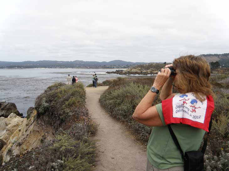
Capture California, the Game-2012
Adventure: 008, Hike 081 -
Salmon Waterfall Trail
Team: Thing One, Thing Two
Date: August 31, 2012
Location: 2.2 miles north of Monterrey County Line off of Highway 1
Hike Info:
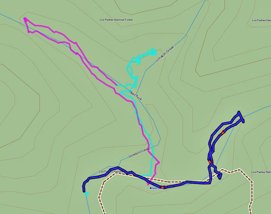
Trail: Salmon Creek Trail to Salmon
Creek Falls
Distance: 0.3 miles
 Duration: 0:19
Elevation Rise: 85'

 After a great day driving down the coast we decided we had one
more hike in us. We had wanted to do this hike last year but ran out
of time and energy, but not this year. Thing One and Thing Two were
on it. We had read about this trail in our Day
Hike on the California Central Coast by Robert
Stone. It was getting close to sunset and we had time for one more
daylight hike. You go a well marked trail. When it forks we took
the left fork to the fall. We could see the falls from the trail
but we scrambled around boulders and view the fall above the base of
the falls. The falls were gorgeous-the picture does not do it justice. It was a great way to end our
day
After a great day driving down the coast we decided we had one
more hike in us. We had wanted to do this hike last year but ran out
of time and energy, but not this year. Thing One and Thing Two were
on it. We had read about this trail in our Day
Hike on the California Central Coast by Robert
Stone. It was getting close to sunset and we had time for one more
daylight hike. You go a well marked trail. When it forks we took
the left fork to the fall. We could see the falls from the trail
but we scrambled around boulders and view the fall above the base of
the falls. The falls were gorgeous-the picture does not do it justice. It was a great way to end our
dayFrom Day Hike on the California Central Coast by Robert Stone:
”The trail follows the first portion of the Salmon Creek Trail to a dynamic waterfall. A short hike leads to the base of Salmon Creek Falls, where a tremendous amount of rushing water plunges from three chutes. The water drops more than 100 feet off the Santa Lucia Mountains onto the rocks and pools. Under the shady landscape of alders and laurels, a cook mist sprays over the mossy green streamside vegetation.” Page 58


