

Adventure: 008, Hike 060 –
Sequoia Trail
Team: Thing One, Thing Two
Date: August 24, 2012
Location: Big Basin Redwood State
Park
Hike Info:
Trail: Sequoia Trail-from Park
Headquarters to Slippery Rock
Distance: 2.0
Duration: 1:00
Elevation Rise: 432'

 Description:
You can go on three different routes with the Sequoia Trail. The first is straight out and back, the second is to connect it with the Skyline to the Sea trail, or the third is the longer connection with the Shadowbrook Trail, which is the one we want to go on. Well, Thing One and Thing Two took on a fourth option, and that was to miss the cut off to the park headquarters and pick up the East Ridge trail. But more on that later.
 Team Thing One
and Thing Two did the Sequoia Trail Loop which connects, in our case,
three trails together: The Sequoia Trail, Shadowbrook Trail and we
mistakenly took the East Ridge Trail to get back to the Park
Headquarters. This description is for the Shadowbrook Trail.
Team Thing One
and Thing Two did the Sequoia Trail Loop which connects, in our case,
three trails together: The Sequoia Trail, Shadowbrook Trail and we
mistakenly took the East Ridge Trail to get back to the Park
Headquarters. This description is for the Shadowbrook Trail.We were in Mountain View, visiting our parents when we decided that we would go back to Fresno via Big Basin. Big Basin has been one of those places we have enjoyed, but not visited enough. There are a splendid amount of hikes through some pretty big trees, in the cool coastal environment with mountain sides which are steep, but passable.

We get to Big Basin about 1:30 and start to hike pretty quickly after that. Your faithful scribe left a GPS on top of the car and needed to make a quick trip back to the car to retrieve it. The day is sunny and the temperature is moderate, low 70's. For us Fresnan's, it is cool--we welcome it.
 Last year when we
hiked the Sequoia Trail, we learned that it is one of the oldest
trails in Big Basin, having its origins back in 1875. It was
originally called the Rodger's Trail for one of the original
homesteaders. This is a walk through an old growth forest in Big
Basin. The trail passes by several camp grounds, including the
Wastahi Walk-In Campground, and comes close to the road on several
occasions. The good side is about a mile and a third, there is a
restroom which you can use. We ended this segment of the trail at
Slippery Rock. But before we get to Slippery Rock we made a
side diversion to Sempervirens Falls. This Fall, when going well,
presents a dreamy falls, under old-growth redwoods, with a fan-like
fall. There was two things which spoiled this view: the falls were a
mere fraction of its self and there was a sign at the base saying, do
not stray from the trail.
Last year when we
hiked the Sequoia Trail, we learned that it is one of the oldest
trails in Big Basin, having its origins back in 1875. It was
originally called the Rodger's Trail for one of the original
homesteaders. This is a walk through an old growth forest in Big
Basin. The trail passes by several camp grounds, including the
Wastahi Walk-In Campground, and comes close to the road on several
occasions. The good side is about a mile and a third, there is a
restroom which you can use. We ended this segment of the trail at
Slippery Rock. But before we get to Slippery Rock we made a
side diversion to Sempervirens Falls. This Fall, when going well,
presents a dreamy falls, under old-growth redwoods, with a fan-like
fall. There was two things which spoiled this view: the falls were a
mere fraction of its self and there was a sign at the base saying, do
not stray from the trail.
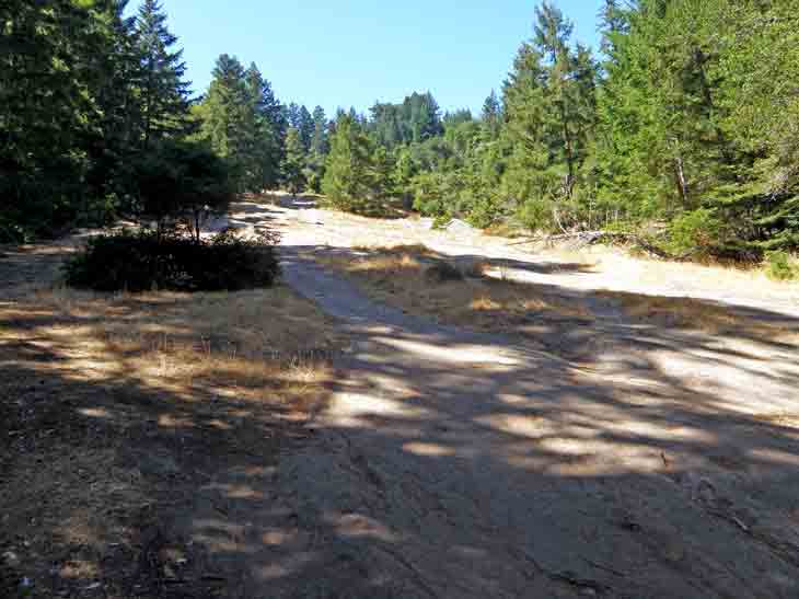

Just beyond Slippery Rock, is the Founders Monument. In 1900 San Jose artist Andrew Hill took a group of local influential men to this place and here the Sempervirens Fund was created, which eventually led to the creation of Big Basin State Park and the entire California State Park system. They camped at Slippery Rock and would go to the Sempervirens Falls to admire its beauty. Slippery Rock is about 200 yards long and rests at a 30 degree angle.
No comments:
Post a Comment