Capture Calif

Capture California

What is a YOLT? Well, you may have heard the term YOLO. Gary and Sherri think we can live again, not as James Bond, but as being reborn. Consequently, we are having fun in our life, after all, You Only Live Twice.

Showing posts with label Indian Grinding Stone SHP. Show all posts

Friday, June 29, 2012

Adventure 053 - Chaw'se


Capture California, the Game-2012
Adventure: 053 - Chaw'se
Team: Thing One, Thing Two
Date:  June 29, 2012
Location: Chaw'se – Indian Grinding Stone State Historic Park

Description:
Chaw'se, literally means grinding stones in the language of the Miwoks. And that is what this State Historical Park is known for. One of two, and by far the largest, grinding stone with petroglyphs. It also features the largest grinding stone with 1,185 mortar holes. Some of the petroglyph carvings are thought to be 3,000 years old and as such can be hard to see. We have found that in our visits here, it is easier to see the carvings during the evening or morning hours, rather than in the direct sunlight, like when we visited this time.


The grounds also feature a complete village of teepee's and a ceremonial hun'ge (roundhouse). The roundhouse still is in use during Big Time events (Pow Wow's). Also the Chaw'se Regional Indian Museum is located at this State Park and contains items showing the Miwok culture and how the coming of European's altered the Miwok's way of life. One thing of local interest for us was the mention of Fort Miller, now underwater at Friant Reservoir. Even more important than the factual, is the flavor of the area. You see, dimly, some of the things which the Miwok held sacred. As the Sierra Nevada Virtual Museum says, Chaw'se is not only a place, but a state of mind.


Adventure 008, Hike 030 - South Nature Trail, Chaw'se


 Capture California, the Game-2012

Adventure: 008, Hike 030 – South Nature Trail, Chaw'se

Team: Thing One, Thing Two

Date:  June 29, 2012
Location: Chaw'se / Indian Grinding Stone State Historical Park
Hike Info:
Trail: South Nature Trail, Chawse
Distance: .7
Description:
 The South Nature Trail is a companion trail to the North Trail. But it is not a repeat of the North Trail. It is surprising how in such a small park, where two trails so close together—they even share about 100 yards of trail—could be so different. While the North Trail is more arid, the South Nature Trail is close to Else Creek. This creek makes for the more moist feeling of the area. As a nature trail, there is 13 points guides, of interest on this self-guided tour. Unfortunately, the box was out of guide booklets, so we guessed what was at each number. Also we went backwards as well. But it was an interesting walk. As we neared the beginning, the trail went close to the park boundary. It was a bit unnerving seeing places where its neighbors would enjoy the settings with their own chairs and tables. Also it looked like there must have been some sort of need for the State to clear brush as we saw a lot of evidence of new growth madrone being cut. Still an interesting and good trail.

Adventure 008, Hike 029 - North Trail, Chaw'se


Capture California 2012, the Game
Adventure: 008, Hike 029 – North Trail, Chawse
Team: Thing One, Thing Two
Date:  June 29, 2012
Location: Chaw'se / Indian Grinding Stone State Historical Park
Hike Info:
Trail: North Trail, Chawse
Distance: 1.6
Duration: 1:17
Elevation Rise: 241'


Description:
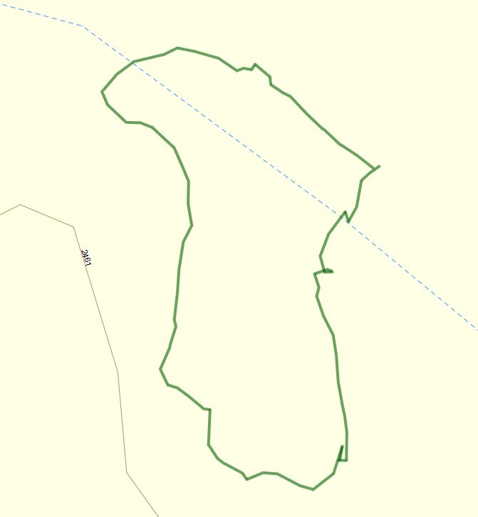
From last September to now, this trail has been improved by a combination of volunteer and State worker partnership. A good part of this trail is now open and accessible to those with mobile restrictions. After about three-quarters of a mile, there is a bench for us to rest at close to the highest point of the trail. But before that, one of the improvements is a new bridge across Else Creek, along with widening and leveling of the trail.


There is a couple variations to this trail. It starts at the Chaw'se Visitor Center and heads northwards, close to the highway. The surrounds is a lot of scrub trees, oaks, and madrones. At one point in the trail, the madrones and manzanita provides a covering which makes yo feel like you are traveling through a red-lined tunnel. At one point, the trail breaks off into a looping area, which eventually rejoins the North Trail close to the bench. After this, the trail starts to descend until it reaches the meadow outside of the Visitor Center. About at this point there is another trail leading to the U' Macha' Tam' Ma' Environmental Camp. As you pass through the meadow, you come across a replica of a Native American teepee village, along with a roundhouse. The trail co-mingles with the South Nature Trail for a hundred yards before going past the Indian Grinding Stones. At this point it is a short walk back to the Visitor Center.


This hike is best done in the evening or morning if done during the summer months.