Capture Calif

Capture California

What is a YOLT? Well, you may have heard the term YOLO. Gary and Sherri think we can live again, not as James Bond, but as being reborn. Consequently, we are having fun in our life, after all, You Only Live Twice.

Showing posts with label 2013-ADV 003. Show all posts

Wednesday, October 30, 2013

Adventure 003, 105-Rangers' Club

Sherri at the Ranger's Club

Capture California, the Game-2013
Adventure: 003, 105-Rangers' Club

National Registry ID: 87001414

Team: YOLT
Date:  October 30, 2013
Location:
Address: Yosemite Valley

Description:
Date Built: 1924
Architect: Charles K Summer


Front of Ranger's Club
National Park Services Superintendent Mather was approached about providing a place in Yosemite where park rangers could get away from their duties and rest and relax. He not only agreed to this proposition, but provided his personal funds to make this happen. Until last year when we were looking around the Valley, we did not know that this building existed and what it was. Today it provides housing for Yosemite's seasonal rangers.


The Rangers' Club was designed by San Francisco architect Charles K. Sumner. Construction was completed in August 1924, at a cost to Mather of $39,380.[4] The Rangers' Club was intended to foster a sense of esprit de corps among the newly-create ranger service. Mather hoped that the example at Yosemite would encourage Congress to appropriate money to build similar facilities at other national parks, a vain hope. The Rangers' Club was the first significant structure on the north side of the Yosemite Valley, part of a Mather strategy to relocate park services. (Wikipedia)


References:


Overall Landmark References:

Adventure 003, 104-Yosemite Village Historic District

Sherri and the US Post Office

Capture California, the Game-2013
Adventure: 003, 104-Yosemite Village Historic District
National Registry ID: 78000354


Team: YOLT
Date:  October 30, 2013
Location:
Address: Yosemite Valley

Description:
Ansel Adams Studios
It is great to be able to wander through the village area, even though at times it does seem to be a bit more commercial than the Valley needs. But when you read about the history of the Valley, you realize that the commercialness is a lot less now than 100 years ago.


The most significant building in the historic district is the Rangers' Club, built at the personal expense of Park Service director Stephen T. Mather in 1924 to house rangers. The National Historic Landmark structure is an early example of the National Park Service rustic style in the park.[3]
Ranger's Club - see Landmark 105

Early residences used wood shingles and natural materials, and were rustic in character. From the mid-1920s, following the construction of the Rangers' Club, houses were more explicitly rustic. The Park Superintendent's Residence was built a little apart from the other houses in 1912 by the Army. The Superintendent's Residence was extensively remodeled in the 1920s to National Park Service rustic standards. The residential district was laid out in an informal style by Park Service landscape architect Charles Punchard.[2]

Non-residential buildings include the Administration Building (1924) designed by architect Myron Hunt, the Post Office (1925), and the Museum Building or Valley District Building (1926), both designed by Park Service architect Herbert Maier. All are rustic in character. Other buildings in the area include the Pohono Indian Studio (1925), which is used as a gift shop, and the Ansel Adams Gallery, a complex of five buildings incorporating what was first known as Best's Studio.[2]


References:


Overall Landmark References:

Adventure 003, 103-Ahwahnee Hotel

Sherri at the Ahwahnee's National Historic Landmark Plaque

Capture California, the Game-2013
Adventure: 003, 103-Ahwahnee Hotel
National Registry ID: 77000149


Team: YOLT
Date:  October 30, 2013
Location:
Address: Yosemite Valley

Description:
Date Built: 1927
Architect: Gilbert Stanley Underwood

What can you say? This place has entertained royality, presidents, and regular people for 85 years and it is still going strong. On a personal note, Gary and Sherri celebrated their 5th anniversary in its dinning are several years back. Just wandering through the building, which the public can enjoy, you understand the immenseness of it, along with the grandour.


The Ahwahnee hotel was designed by architect Gilbert Stanley Underwood (who also designed the Zion Lodge, Bryce Canyon Lodge, and Grand Canyon North Rim Lodge), with interior design directed by Dr. Phyllis Ackerman and Professor Arthur Upham Pope.[4]
The Ahwahnee
The site for the hotel is below the Royal Arches rock formation in a meadow area that had served in the past as a village for the native Miwoks, who formerly lived in the valley, and a stables complex known as Kenneyville. The site was chosen for its views of many of the iconic sights in Yosemite, including Half Dome, Yosemite Falls and Glacier Point, and its exposure to the sun allowing for natural heating.[5]
The hotel was constructed from 5,000 tons (4,535 t) of rough-cut granite, 1,000 tons (907 t) of steel, and 30,000 feet (9,140 m) of timber.[5] The 'wood siding' and 'structural timber' on the exterior of the hotel is actually formed of stained concrete poured into molds to simulate a wood pattern.[4] Concrete was chosen as the material for the outside 'wood' elements to add fire resistance to the hotel. The construction lasted 11 months and had a cost of US$1,225,000 upon completion in July 1927 (Wikipedia)


References:


Overall Landmark References:

Wednesday, October 23, 2013

Adventure 003, Site 102-Canal Farm Inn-Los Banos

Sherri at Canal Farm Inn
Capture California, the Game-2013
Adventure: 003, Site 102-Canal Farm Inn-Los Banos
California Landmark Number: 548

Team: YOLT
Date:  October 23, 2013
Location:
Address: 1460 E Pacheco Blvd, Los Banos


Description:
Espana's now resides at this location—this is a place Sherri and Gary year after year say we want to go and eat at. But we have yet to do so. Maybe this coming year. But the place does have significant local history which we discovered last year. See our notes from there.
Canal Farm Inn
NO. 548 CANAL FARM INN - This original San Joaquin Valley ranch headquarters of California pioneer and cattle baron Henry Miller (1827-1916) was established in 1873. His farsighted planning and development in the 1870s of a vast gravity irrigation system, and the founding of Los Banos in 1889, provided the basis for this area's present stability and wealth.
Location: 1460 E Pacheco Blvd, Los Banos


References:


Overall Landmark References:

Tuesday, October 22, 2013

Adventure 003, Site 098-LeConte Memorial Lodge

Sherri at LeConte Memorial Lodge
Capture California, the Game-2013
Adventure: 003, Site 098-LeConte Memorial Lodge
National Registry of Historic Places ID: 19770308 or 77000148

Team: YOLT
Date:  October 22, 2013
Location:
Address: Yosemite Valley

Description:
Date Built: 1903
Architect: John White


LeConter Memorial Lodge


What is this castle looking like building doing under the shadow of Glacier Point? First, Professor LeConte, whose memorial this is, was a major force in the early Sierra Club. The Sierra Club built this building as a place to store its books and historical documents. During the summer times, the ledge is open to the public-a friend of ours served as a docent there this summer.


References:


Overall Landmark References:


Adventure 003, Site 100-Yosemite Valley Chapel

Sherri at the Chapel
Capture California, the Game-2013
Adventure: 003, Site 100-Yosemite Valley Chapel
National Registry of Historic Places ID: 73000256

Team: YOLT
Date:  October 22, 2013
Location:
Address: Yosemite Valley

Description:
Date Built: 1879


Unless you are a bride, or groom, you may not have been to this building before. While it has, in my opinion the best view of Yosemite Falls in the Valley, not many people in comparison will come to this site to enjoy it. It has been part of the Valley scenery since 1879. Thousands of people have been married here. Many more have been memorialized here as well-there is a registry of those who have been laid to rest in the park located at the site. Here you can get a feeling of serenity and peace from the rush of the Valley.


References:


Overall Landmark References:

Adventure 003, Site 101-Yosemite Valley Bridges

Sherri and the Yosemite Creek Bridge
Capture California, the Game-2013
Adventure: 003, Site 101-Yosemite Valley Bridges
National Registry ID: 77000160

Team: YOLT
Date: 
  • October 22, 2013
  • May 16, 2013
  • August 10, 2013
Location:
Address: Yosemite Valley Bridges
Happy Isles Bridge

Happy Isles Bridge

Pohono Bridge


Description:
So many bridges! Such long standing structures!. Looking down from Glacier Point you see them dotting the Valley, up close and as you walk over them, you enjoy views unmatched by almost all bridges in the world. We were able to either cross or see the following bridges:
  • Yosemite Creek Bridge—Pedestrians are no longer welcome on this narrow bridge. Still looking at the bridge, you admire how it looked.
  • Pohono Bridge—the bridge at the western end of the Valley. Usually the Merced River here is peaceful, leaving you to dream, whether it is Spring or Fall.
  • Happy Isles Bridge. The first bridge in the Valley where the Merced crosses under.


From the NPS Brochure on Yosemite Valley Historical Bridge:
The Yosemite Creek Bridge is the oldest, carrying the North Road and spanning Yosemite Creek below Yosemite Falls. Built in 1922, it spans 50 feet (15 m) in a single arch of reinforced concrete faced with granite. The bridge is 24 feet (7.3 m) wide, and was built at a cost of $32,000. The bridge originally featured lanterns on the buttresses at either end of the bridge.[2] It replaced an earlier bridge, referred to as "the little red bridge."[4]
The Ahwanee Bridge was built in 1928 across the Merced with three arches, one spanning 42 feet (13 m) and the others spanning 39 feet (12 m), for a total length of 122 feet (37 m). The bridge is 39 feet (12 m) wide with a 27 feet (8.2 m) roadway, a 5 feet (1.5 m) sidewalk and a 7 feet (2.1 m) bridle path. It carries the Mirror Lake Road, framing a view of Half Dome for eastbound traffic. Cost was $59,913.09.
The Clark Bridge was also built in 1928 with a single 75.5-foot (23.0 m) semi-elliptical main span flanked by two round-arched subways for horse-and-rider traffic, 7 feet (2.1 m) wide by 11 feet (3.4 m) high through the bridge's abutments. Cost was $40,061.22. The bridge carries the 27-foot (8.2 m) Curry Stables Road, a 5 feet (1.5 m) sidewalk and a 7 feet (2.1 m) bridle path.
The Pohono Bridge (1928) spans 80 feet (24 m), carrying the 27-foot (8.2 m) El Portal Road and a 5 feet (1.5 m) bridle path, at a cost of $29,081.55.
Pohono Bridge
The Sugar Pine Bridge (1928), also historically known as the Kenneyville Bridge No. 2, spans 106 feet (32 m) at a five-degree skew across the river, with a 27-foot (8.2 m) roadway, a 5-foot (1.5 m) sidewalk and a 7-foot (2.1 m) sidewalk. It carries the Mirror Lake Road. The longest span of the eight bridges, the cost was $73,507.44. The bridge was named for a large sugar pine that grew to the north of the east bridge abutment.[5]
The Tenaya Creek Bridge (1928) spans Tenaya Creek with a single 56.75-foot (17.30 m) arch at a 25-degree skew on the Happy Isles-Mirror Lake Road. The bridge carries the standard roadway, bridle path and sidewalk. Cost was $37,749.16.
The Happy Isles Bridge on the Happy Isles Road was built in 1929 with one span of 75 feet (23 m) and two equestrian subways in its abutments similar to those of the Clark Bridge, its near twin. The bridge's total length is 126 feet (38 m). Cost was $46,673.03.
The Stoneman Bridge (1933) resembles the Clark and Happy Isles bridges, with a 72-foot (22 m) main span carrying a 27-foot (8.2 m) road and two 6-foot (1.8 m) sidewalks. The equestrian subways in the abutments were slightly enlarged in width to 8.5 feet (2.6 m) and were extended out from the surface of the wing walls for greater emphasis. It is located at the Camp Curry intersection. Cost was $71,675.08.[2] The bridge replaced a wooden bridge that had carried the former "Royal Arch Avenue" to the Stoneman Hotel, which had been demolished by the 1920s. Construction on the bridge was started by Sullivan and Sullivan of Oakland, California, but was terminated when the Bureau of Public Roads lost confidence in the contractor's ability to carry out the work. The bridge was completed by the Portland, Oregon firm of Kueckenberg & Wittman.[6]


References:


Overall Landmark References:

Adventure 003, Site 099-Camp 4

Sherri at Camp 4 (There may be a plaque, but not found)
Capture California, the Game-2013
Adventure: 003, Site 099-Camp 4
National Registry of Historic Places ID: 030221 or 03000056

Team: YOLT
Date:  October 22, 2013
Location:
Address: Yosemite Valley

Description:
As much time as we have spent in the Valley, we cannot think of a time we have camped in Camp4, or sometimes known as Sunnyside Campground. We have walked through it several times and understand the deep historical significance of the place.


Currently Camp 4 is a walk in camp. So it is a combination of people parking cars and walking in 100 yards to climbers waiting for the early morning light for the big climb to backpackers to campers who want a cheap place to sleep in the Valley. Whatever the reason, there is a patchwork of color on the Valley floor where Camp 4 is.


The American Alpine Associations says this:
Camp 4 is such a simple setting: forested space, boulders, campsites, sun in the morning, views across the Valley, closeness to the easy Swan's Slab, and closeness to the ever challenging El Capitan. The simplicity itself is part of Camp 4's evocative force. Climbers, by their very nature, seek a direct, intense interaction with nature. For them, the spareness of the campground is far more evocative than any of the more luxurious lodgings available in the Valley.
References:


Overall Landmark References:


Friday, October 18, 2013

Adventure: 003, Site 097-SITE OF FIRST JUNIOR COLLEGE IN CALIFORNIA

Sherri at the Site of the First JC in California
Capture California, the Game-2013
Adventure: 003, Site 097-SITE OF FIRST JUNIOR COLLEGE IN CALIFORNIA
California Landmark Number: 803

Team: YOLT
Date:  October 18, 2013
Location:
Coordinates: N 36° 44.530 W 119° 47.385
Address: Stanislaus St. & O S, Fresno

Description:
Last year when we playing Capture California, we searched high and low for this plaue, but could not find it. There used to be a car dealership at this site after it was finished with its educational function. But about ten years ago, Fresno Unified school District re-established the education component to the site and made the site into an Adult School.


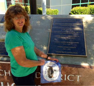
Original Fresno High Cornor Stone-Predated Fresno JC
But what happened to the California Historical Landmark plaque? We asked a local history person who is a friend of ours where we would find it. He told us to go inside the school and there is a plaque there. Sure enough, this year we found a plaque stating this site was California's First Junior College. But this was not the California plaque. We asked the staff at the site and no one knew. So we submitted this current historical plaque.


NO. 803 SITE OF FIRST JUNIOR COLLEGE IN CALIFORNIA - Constructed in 1895, the school was known as Fresno High School from 1895-1921. Established as the first junior college of California in 1910, in 1911 it became a normal school, forerunner to Fresno State College. From 1921 to 1948 it was called Fresno Technical High School, and Fresno Junior College from 1948 to 1959. Plaque placed by the Fresno Tech Alumni Association.
Location: NE corner of intersection of Stanislaus and 'O'Sts, Fresno

Current Plaque On Site Reads:
  • The Plaque Reads:
    Historical Landmark Commemorating
    Fresno Technical School
    Constructed 1895
    Known as The Fresno High School
    from 1895-1921
    Established As The First Junior College of California 1910
    Normal School, Forerunner To
    Fresno State College
    1911 Fresno Technical High School
    1921 - 1948
    Fresno Junior College
    1948 to 1959
    Fresno Tech Alumni Assn.


References:


Overall Landmark References:


Monday, October 7, 2013

Adventure 003, Site 096-Cabrillo Bridge


Gary  on Cabrillo Bridge
Capture California, the Game-2013
Adventure: 003, Site 096-Cabrillo Bridge
San Diego Historic Civil Engineering Landmark of the American Society of Civil Engineers

Team: YOLT
Date: October 7, 2013
Location:
Coordinates: 32.731412°N 117.154185°W
Address: El Prado, San Diego

Description:
Date Built: 1914
Architect: Frank P. Allen, Jr. and Thomas B. Hunter


This bridge was built for the 1915-16 Panama-California Exposition in San Diego, along with a good part of the buildings in Balboa Park. We sort of thought this bridge was historic, but could not find it on the NRHP. But as we were walking the bridge, we found that it had a plaque indicating it was on the American Society of Civil Engineers Historical Buildings list. Great! You can read about our walk across the bridge in this blog.


References:


Overall Landmark References:

Adventure 003, Site 092-California Quadrangle

Gary and Dad at Calif Quadrangle

Capture California, the Game-2013
Adventure: 003, Site 092-California Quadrangle
National Registry of Historic Places ID: 19740517

Team: YOLT
Date:  October 7, 2013
Location:
Coordinates: 32°43′53.5044″N 117°09′8.481″W
Address: El Prado Ave

Description:
Date Built: 1911-1915
Architect: Bertram Goodhue
Facing the California Quadrangle


The core of Balboa Park is right in the center, which is the California Quadrangle. The Quadrange was built for the 1915-16 Panama-California Exposition. The buildings and the area reflect the Spanish style architecture to celecbrate the conquests of Cabrillo, de Portola, and others, along with Junipero Sierra's mission influence. The area comprises of the California State Building, Fine Arts Building-now the Museum of Man, Evernham Hall, and Francis Chapel.


References:


Overall Landmark References:


Adventure 003, Site 093-El Prado Complex

Gary at the heart of El Pardo
Capture California, the Game-2013
Adventure: 003, Site 093-El Prado Complex
National Registry of Historic Places ID: 1976000515

Team: YOLT
Date:  October 7, 2013
Location:
Address: El Prado, Balboa Park, San Diego

Description:
Date Built: 1911-1916


We came to Balboa Park on a fine sunny Monday afternoon. After we crossed Cabrillo Bridge, we headed straight down El Prado into the the heart of Balboa Park. As we were facing east, there was the historic El Prado complex. It now houses museums, gardens and other cultural attractions.


References:


Overall Landmark References:


Adventure 003, Site 091-Balboa Park

Gary at Balboa Park
Capture California, the Game-2013
Adventure: 003, Site 091-Balboa Park
National Registry of Historic Places ID: 19771222 and 77000331
Local Registry ID: 1

Team: YOLT
Date:  October 7, 2013
Location:
Coordinates: 32° 43′ 53″ N, 117° 8′ 43″ W

Description:
Date Built: 1868


This park's history stretches back to well before San Diego was incorporated. In 1835 the Spanairds issued a land grant of 47,000 acres for recreational purposes. Since that time, while the area of the recreational size of the park has diminshed, this park continues to be promient in its recreational, educational and artistic facilities.


We enjoyed walking around the area, even going into the botanical gardens and listening to a bit of guitar and saxaphone music. We did this for about an hours


References:


Overall Landmark References:

Adventure 003, Site 094-San Diego Veteran's Museum and Memorial Center

Gary and Dad at Center

Capture California, the Game-2013
Adventure: 003, Site 094-San Diego Veteran's Museum and Memorial Center
National Registry of Historic Places ID: 20000928 or 2000001167
(we have conflicting numbers)

Team: YOLT
Date:  October 7, 2013
Location:
Coordinates: 32°44′19″N 117°08′50″W
Address: 3325 Zoo Dr., San Diego
Veteran's Memorial Garden

Description:
Last year when we were in San Diego, we visited Balboa Park. There was a lot to see and do. One of the things which was moving was the Veteran's Museum-it was closed then. So we wanted to visit it with Gary's Dad who served in World War II. Unfortunately, it was closed on Monday's. So we were content with seeing the Veteran's Memorial Garden, in front of the Center.


From Veteran's Museum site:
The site chosen for the location of the Veterans Museum & Memorial Center was the former San Diego Naval Hospital Chapel at Inspiration Point in Balboa Park, part of a complex of architecturally significant buildings with rich historical connections to the San Diego region's naval heritage.


References:


Overall Landmark References:

Adventure 003, Site 095-Mission San Diego de Alcala

Capture California, the Game-2013

Sherri and the Mission Sign
Adventure: 003, Site 095-Mission San Diego de Alcala
California Landmark Number: 242
National Registry of Historic Places ID: 70000144

Team: YOLT
Date:  October 7, 2013
Location:
Coordinates: 32° 47.056′ N, 117° 6.377′ W
Address: 10818 San Diego Mission Road, San Diego CA 92108

Description:
Date Built: 1769
Architect: Fr. Jose Bernardo Sanchez


While in San Diego visiting Gary's aunt, we visited several things, such as Balboa Park and La Jolla. One of the things we did was stop by Mission San Diego. We did a lot more looking last year, while this year it was only seeing the outside of the mission this year.
Front of Mission


From plaque:
On Sunday, July 16, 1769 Fathers Junipero Serra, Juan Viscaino and Fernando Parron raised and blessed a cross to establish Alta, California’s 1st Mission. Relocated from Presidio Hill to this site in August 1774 the Mission was the mother of those founded in California by the Franciscan Order. The present buildings, first completed in 1813 were rebuilt in stages from 1915 to 1931 after many years of deterioration. They have been in use as a parish church since February 1941.


References:


Overall Landmark References:


Friday, October 4, 2013

Adventure 003, Site 090-Fort Tejon

Gary at Ft Tejon
Capture California, the Game-2013
Adventure: 003, Site 090-Fort Tejon
California Landmark Number: 129
National Registry ID: 1971000140


Team: YOLT
Date:  October 4, 2013
Location:
Coordinates: Latitude: 34° 52.394′ N, 118° 53.73′ W
Address: Fort Tejón State Historic Park


Description:
As you go up the Grapevine from Bakersfield, you pass by Fort Tejon State Historical Park. A few miles further is a rest stop. We asked ourselves, why not just stop at the Fort for a break and gather in a little bit of our history? So last year we did that and enjoyed ourselves. Since then, we have made it a tradition of stopping here on our way down to see our daughter. The good thing about this year is that we were a bit earlier and with Gary's parents. So we got out and enjoyed the area, including touring the barracks and the capitan's home. Not bad for a rest break.


From NRHP:
This military post was established by the United States Army on June 24, 1854, to suppress stock rustling and to protect Indians in the San Joaquin Valley. As regimental Headquarters of the First Dragoons, Fort Tejon, was an important military, social, and political center. Camels for transportation were introduced here in 1858. The fort was abandoned September 11, l864. Subsequently, it became headquarters for the Tejon Ranch until acquired by the State in 1940. Considerable restoration reconstruction is planned for the area.


From the History of Fort Tejon:
Fort Tejon is located in the Grapevine Canyon, the main route between California's great central valley and Southern California. The fort was established to protect and control the Indians who were living on the Sebastian Indians Reservation, and to protect both the Indians and white settlers from raids by the wide-ranging and rather warlike Paiutes, Chemeheui, Mojave, and other Indian groups of the desert regions to the south east. Fort Tejon was first garrisoned by the United States Army on August 10, 1854 and was abandoned ten years later on September 11, 1864.


References:


Overall Landmark References: